
Lake dwellings of the Western Baltic Barrow Culture are among Poland's least explored archaeological sites. Their function and origin have never been clearly defined, and the community that constructed them remains mysterious. Knowledge about these sites derives primarily from historical German archives, with only a few having undergone archaeological investigation.
back
Project Objective
A non-invasive survey conducted by the Centre for Underwater Archaeology at Nicolaus Copernicus University included aerial photography, hydroacoustic scanning, and underwater prospection to verify a selected group of sites. This was a pilot project aimed at assessing the scientific potential of the subject. At the same time, it constituted the first such comprehensive identification of lake dwellings using remote sensing methods. The detailed goal was to employ the abovementioned techniques to determine the extent and character of the settlements' underwater and shoreline constructions and verify their existence.Aerial Photography
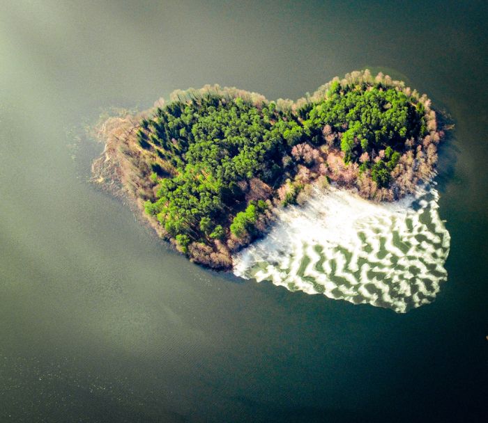
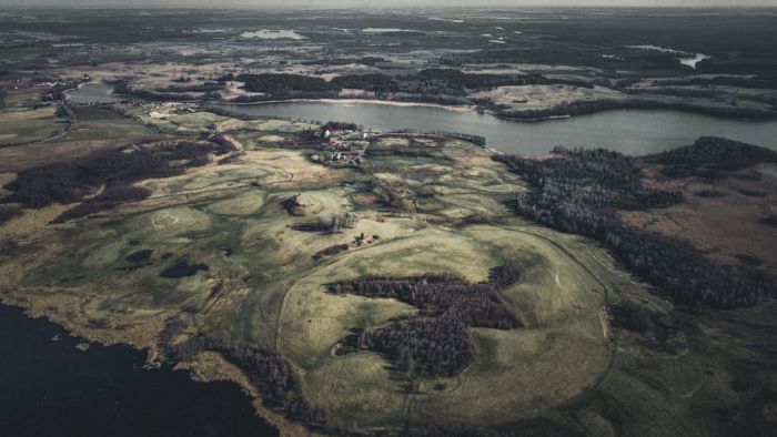
Aerial photographs of selected areas were taken first. The flights were conducted under favourable weather conditions and at an appropriate time, using an unmanned aerial vehicle (UAV) flying at 100 meters. Both vertical images, used to create orthophotos, and oblique images, which highlight topographic details, were taken.
Sonar Scanning
The water levels in two lakes were too low for the motorboat to enter, preventing the hydroacoustic surveys from being conducted. The remaining lakes were scanned using a single-beam echo sounder and a Humminbird side-scan sonar. Survey lines were spaced 20 meters apart. In locations with notable topographic features or sonar anomalies, the line density was increased to obtain the most comprehensive image of the lakebed.
Underwater Prospection
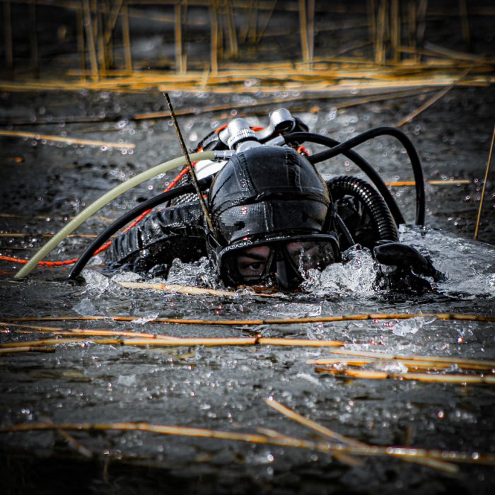
The following research stage involved underwater prospection. A team of divers investigated the lakes believed to contain lake dwellings. The dives followed best diving practices to ensure team safety. Bathymetric anomalies identified during the hydroacoustic surveys were also examined. On the two aforementioned lakes, the low water level and dense vegetation made it impossible to approach by boat, and thus, prospection could not be carried out.Data Processing
After the fieldwork, data analysis was conducted. Aerial images were processed using MetaShape software to produce orthophotos with a 20 x 20 cm resolution and Digital Elevation Models (DEMs) with a 0.5 x 0.5 m resolution. Hydroacoustic data were processed using ReefMaster, resulting in sonar mosaics and bathymetric terrain models with a 1 x 1 m resolution. The resulting data were imported into QGIS and integrated. This provided a comprehensive image of the lake settlements of the Western Baltic Barrow Culture and their surrounding areas. The primary goal was to verify the existence of these sites in selected lakes. In three cases, the presence of settlements was confirmed. In others, the results were inconclusive and require further analysis and investigation.Funding: IDUB UMK – DEBIUTY
Project Lead: Mateusz Popek
Team: Andrzej Pydyn, Konrad Lewek, Szymon Mosakowski, Marta Piotrowska, Jonasz Kołecki